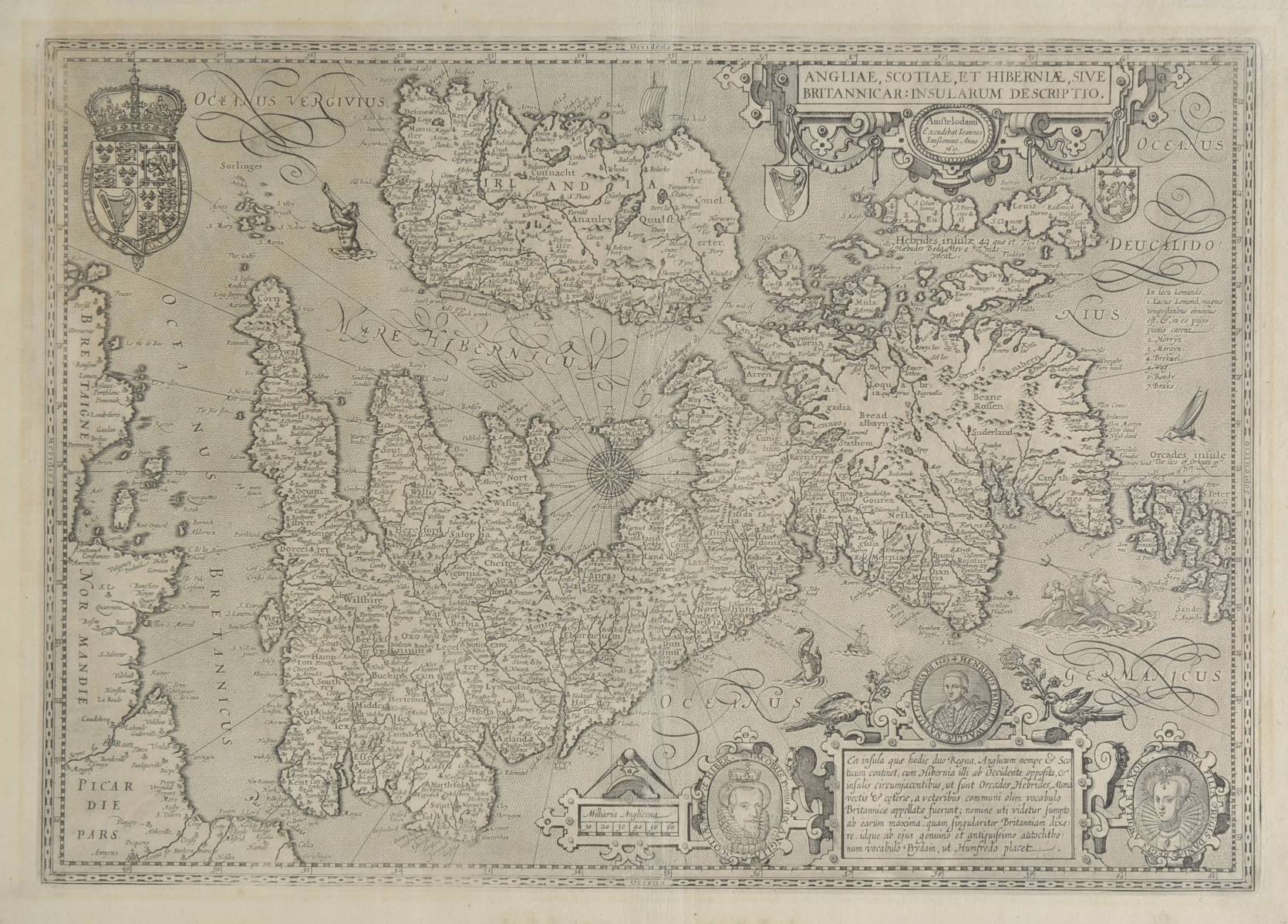
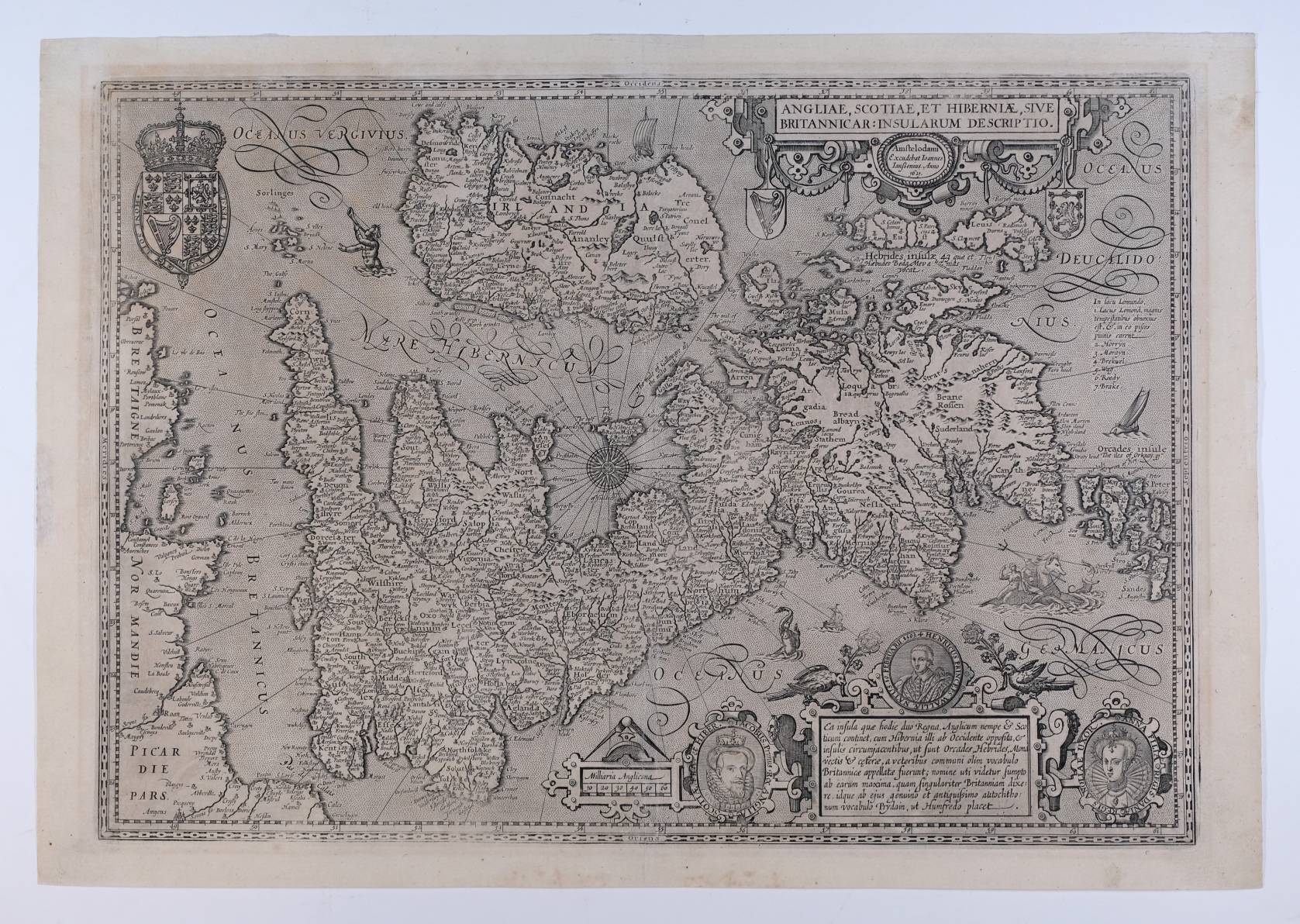
British Isles. Jansson (Jan), Angliae, Scotiae et Hiberniae, sive Britannicar: Insularum descriptio,
British Isles. Jansson (Jan), Angliae, Scotiae et Hiberniae, sive Britannicar: Insularum descriptio, Amstelodami Ioannes Janssonius Anno. 1621, uncoloured engraved map orientated to the west, central fold partially strengthened on verso, left hand margin with repaired closed tear, not affecting image, 350 x 500 mm R.W.Shirley. Early Printed Maps of the British Isles 1477 - 1650, no. 374. A scarce map. A re-issue of Pieter van den Keere's map of 1604, which in turn bears a striking resemblance to Ortelius's map of 1570. The map shows the British Isles under the newly installed James I with portraits of himself and his wife and son. There is also a royal coat of arms in the Stuart form. (1)
- The cost is converted to USD at the rate of 1 GBP = 1.276175 USD on 2017-06-14.
-
Sign in to view
Lot number
-
Sign in to view
Estimate
-
2017-06-14
Sale date
-
Sign in to view
Realised price
-
Sign in to view
Opening price
-
Sign in to view
House name
-
Sign in to view
Auction sale name
-
Sign in to view
Country
-
Categories
Sign in to view -
Tags
Sign in to view
SIMILAR AUCTION ITEMS