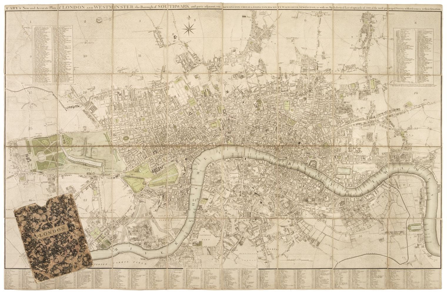
London. Cary (John), Carys New and Accurate Plan of London and Westminster..., 1806
London. Cary (John), Cary's New and Accurate Plan of London and Westminster, the Borough of Southwark and parts adjacent: viz. Kensington, Chelsea, Islington, Hackney, Walworth, Newington &c with an Alphabetical list of upwards of 500 of the most principal streets with references to their situation, 1806, engraved map, sectionalised and laid on linen, contemporary outline colouring, with a list of over 500 of the principal streets, contained in a contemporary marbled card slipcase with printed label to upper board, rubbed at extremities, 815 x 1245 mm Qty: (1) Footnote: James Howego. The Printed Maps of London, no.184, state 9 (of 20).
- The cost is converted to USD at the rate of 1 GBP = 1.307625 USD on 2022-04-06.
-
Sign in to view
Lot number
-
Sign in to view
Estimate
-
2022-04-06
Sale date
-
Sign in to view
Realised price
-
Sign in to view
Opening price
-
Sign in to view
House name
-
Sign in to view
Auction sale name
-
Sign in to view
Country
-
Categories
Sign in to view -
Tags
Sign in to view
SIMILAR AUCTION ITEMS